-
14,79
USD
-
* Free shipping to US.
-
-
Not available
Features:
- Pages: 195
- Format: 19,5x12,5x0,50 cm
- Edition Date: 2017
- Edition: 1
- Language: Castellano.
- Binding: Libro en otro formato.
- Weight: 0,064 kg.
-
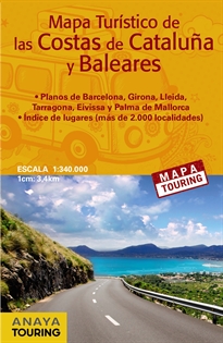
Mapa turístico de las Costas de Cataluña y Baleares (desplegable), escala 1:340.000
-
9788499359700
-
-
-
-
-
-
Mapa turístico de las costas de Cataluña y Baleares a escala 1:340.000. Incluye toda la información turística para viajar por estas comunidades (vistas panorámicas, castillos, monumentos, paradores, las mejores playas, recorridos pintorescos...).
-
14,79
USD
-
* Free shipping to US.
-
-
Not available
The book belongs to the following catalogs
Other books in the subject Atlas Y Mapas De Carreteras:
-
18,79
USD
-
18,79
USD
-
19,97
USD
-
35,04
USD
-
18,79
USD
-
18,79
USD